About Coordinator-Collect Coordinate
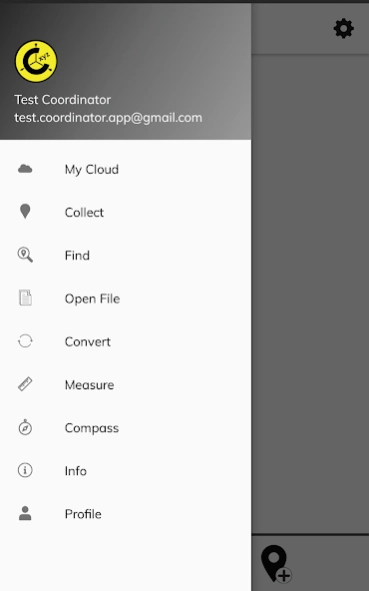
Using Coordinator app, you can collect coordinate data from land on whatever coordinate system you want, choosing from defined systems. You can collect GPS coordinates. You can use the app as a GPS tracker. You can view a...
Using Coordinator app, you can collect coordinate data from land on whatever coordinate system you want, choosing from defined systems. You can collect GPS coordinates. You can use the app as a GPS tracker. You can view a coordinate data on the map and also search by address and see that on the map. You can get directions to that point. You can search by longitude/latitude. You can convert an existing coordinate into another coordinate system. You can do this by typing coordinates manually or opening an XLSX file which contains coordinates. You can display circumference and area measurements of some coordinates by opening the file which created before. Also you can measure distance and area for some coordinates which determined manually on the map. You can display a KML file on the map. There is also a compass tool. Coordinator app contains several useful tools for people interested in coordinates, maps and geographic information systems (GIS).
All of the features above are free.
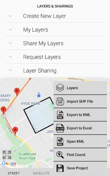
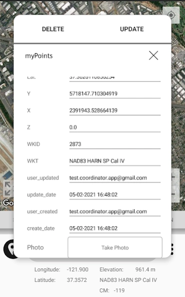
On the other hand if you become a Coordinator Pro subscriber, you can benefit from many extra features in addition to these features. With Coordinator Pro, subscribers can use some extra features such as Cloud Database Functions (creating points, lines & polygons, sharing your layers with teammates, working simultaneously with teammates, working offline and synchronizing, etc), exporting to KML & Excel files, making elevation & address querying and so on. It is ad-free.
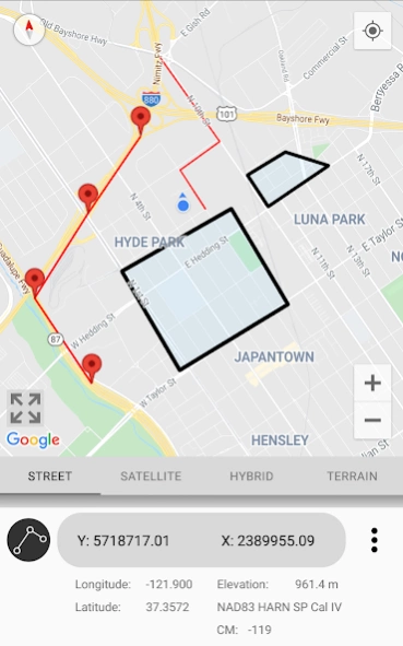
Besides longitude/latitude, subscribers can find out the altitude value of a point on the map. You can search by address and so that locate it on the map and learn the GPS coordinate (longitude/latitude or northing/easting) value of this place. The address locating feature works based on maps services and it's very effective.
If you are a subscriber, you can use the Coordinator Web app. So that you can use the cloud database features of the Coordinator app on the web page on your computer and monitor the data instantly. You can view/track and edit cloud database data on the web page. In this way, you can instantly monitor the data movements made in the mobile app in the field, in the web browser on your computer.
The coordinate systems of the countries, which the app is most downloaded, are added to the app.
Current list of the countries and their coordinate systems defined in this app:
World - GPS(WGS 84)
World - WGS 84 - 6 ̊ UTM
United States - "NAD 1983 HARN State Plane Coordinate Systems(meters & feet)" and "Military Grid Reference System (MGRS)"
Algeria - "Nord Sahara 1959 / UTM 6 ̊ "
Azerbaijan - "Pulkovo 1942 / Gauss-Kruger 3 ̊ " and "Pulkovo 1942 / CS63"
Bulgaria - "Pulkovo 1942(58) GK 6 ̊ "
Germany - "DHDN/3 ̊ GK" and "ETRS89 UTM 6 ̊"
India - "Kalianpur 1975 / India" and "Kalianpur 1975 / UTM 6 ̊"
Indonesia - "Indonesia 1974 UTM 6 ̊" and "DGN 1995 Indonesia TM3 ̊"
Iran - "ED50(ED77) / UTM 6 ̊"
Iraq - "Nahrwan 1967 / UTM 6 ̊" and "ED50 / Iraq National Grid" and "Karbala 1979 / UTM 6 ̊"
Israel - "Palestine 1923/Palest. Grid" and "Palestine 1923/Israeli CS Grid" and "Israel 1993/Israeli TM Grid"
Lebanon - "Deir ez Zor / Levant Ster." and "Deir ez Zor / Syria Lambert"
Mauritania - "Mauritania 1999 / UTM 6 ̊"
Morocco - "Merchich / Nord Maroc" and "Merchich / Sud Maroc"
Netherlands - "Amersfoort / RD New" and "Amersfoort / RD Old"
Palestine - "Palestine 1923/Palest. Grid" and "Palestine 1923/Israeli CS Grid" and "Israel 1993/Israeli TM Grid"
Philippines - "Luzon 1911 / Philippines" and "PRS92 / Philippines"
Romania - "Dealul Piscului 1930 / Stereo 33" and "Pulkovo 1942(58) / Stereo 70"
Russia - "Pulkovo 1942 / Gauss-Kruger 3 ̊"
Saudi Arabia - "Ain el Abd / UTM 6 ̊" and "Ain el Abd / Aramco Lambert"
Syria - "Deir ez Zor / Levant Ster." and "Deir ez Zor / Syria Lambert"
Turkey - "ITRF 96 - 3 ̊" and "ED 50 - 3 ̊" and "ITRF 96 - 6 ̊" and "ED 50 - 6 ̊"
United Arab Emirates - "Nahrwan 1967 / UTM"
Previous Versions
Here you can find the changelog of Coordinator-Collect Coordinate since it was posted on our website on 2017-01-06 02:12:10.
The latest version is 7.6.1 and it was updated on 2024-04-19 18:34:23. See below the changes in each version.
Coordinator-Collect Coordinate version 7.6.1
Updated At: 2024-01-15
Changes: Some bug fixes and performance improvements.
Coordinator-Collect Coordinate version 7.5.1
Updated At: 2023-06-12
Changes: Added color options for points, lines and polygons.
Some bug fixes and performance improvements.
Coordinator-Collect Coordinate version 7.4.2
Updated At: 2023-01-31
Changes: Added Brazil coordinate systems
Some UI updates.
Some bug fixes and performance improvements.
Coordinator-Collect Coordinate version 7.1.8
Updated At: 2022-02-21
Changes: Bug fixes and performance improvements.
Coordinator-Collect Coordinate version 7.1.6
Updated At: 2021-11-08
Changes: Some bug fixes.
Coordinator-Collect Coordinate version 7.1.3
Updated At: 2021-06-14
Changes: Added login method by creating account with email address.
Some bug fixes.
Coordinator-Collect Coordinate version 7.1.2
Updated At: 2021-04-26
Changes: ---7.1.2---
Some bug fixes.
Coordinator-Collect Coordinate version 7.1.0
Updated At: 2021-04-24
Changes: ---7.1.0---
Some bug fixes.
Some radical user interface updates.
Coordinator Pro option added. So that subscribers can use some extra features such as Cloud Database Functions, exporting to KML & Excel files, importing ESRI SHP files, making elevation & address querying and so on. It is ad-free.
Coordinator-Collect Coordinate version 7.0.4
Updated At: 2021-02-23
Changes: ---7.0.4---
Some bug fixes.
Some radical user interface updates.
Coordinator Pro option added. So that subscribers can use some extra features such as Cloud Database Functions, exporting to KML & Excel files, importing ESRI SHP files, making elevation & address querying and so on. It is ad-free.
Coordinator-Collect Coordinate version 7.0.3
Updated At: 2021-02-12
Changes: ---7.0.3---
Some radical user interface updates.
Coordinator Pro option added. So that subscribers can use some extra features such as Cloud Database Functions (creating points, lines & polygons, sharing your layers with teammates, working simultaneously with teammates, working offline and synchronizing, etc), exporting to KML & Excel files, importing ESRI SHP files, making elevation & address querying and so on. It is ad-free.
Disclaimer
Official Google Play Link
We do not host Coordinator-Collect Coordinate on our servers. We did not scan it for viruses, adware, spyware or other type of malware. This app is hosted by Google and passed their terms and conditions to be listed there. We recommend caution when installing it.
The Google Play link for Coordinator-Collect Coordinate is provided to you by apps112.com without any warranties, representations or guarantees of any kind, so access it at your own risk.
If you have questions regarding this particular app contact the publisher directly. For questions about the functionalities of apps112.com contact us.